

Geospatial Machine Learning
Combining geospatial data with machine learning to gather usable insights
Geospatial analytics leverages spatial data, location data, satellite and aerial imagery or any other form of geographic information, using artificial intelligence to gather usable insights and structured information for various applications. We combine geospatial data with machine learning in collaboration with partners at universities, conservation agencies, and NGOs in projects that support disaster response, humanitarian action and conservation efforts. Some of these projects include:

Turkey Building Damage Assessment
After the earthquake in Turkey on February 6th, 2023, the AI for Good Lab utilized artificial intelligence (AI) methods and high-resolution satellite imagery to assess the extent of damage to buildings in the affected region. Specifically, we partnered with Turkey’s Ministry of Interior Disaster and Emergency Management Presidency (AFAD) to deliver building-level damage estimates over four cities in southeast Turkey using satellite imagery from the first 3 days of the disaster.
TorchGeo: a Python library for deep learning with geospatial data
TorchGeo is a Python package for integrating geospatial data into the PyTorch deep learning ecosystem, making it easy for machine learning and remote sensing experts to use geospatial data in their workflows. TorchGeo provides data loaders for a variety of benchmark datasets, composable datasets for generic geospatial data sources, samplers for geospatial data, and transforms that work with multispectral imagery. You can easily use it with your existing PyTorch training setups.
Publication (opens in new tab) | Get the TorchGeo code > (opens in new tab)
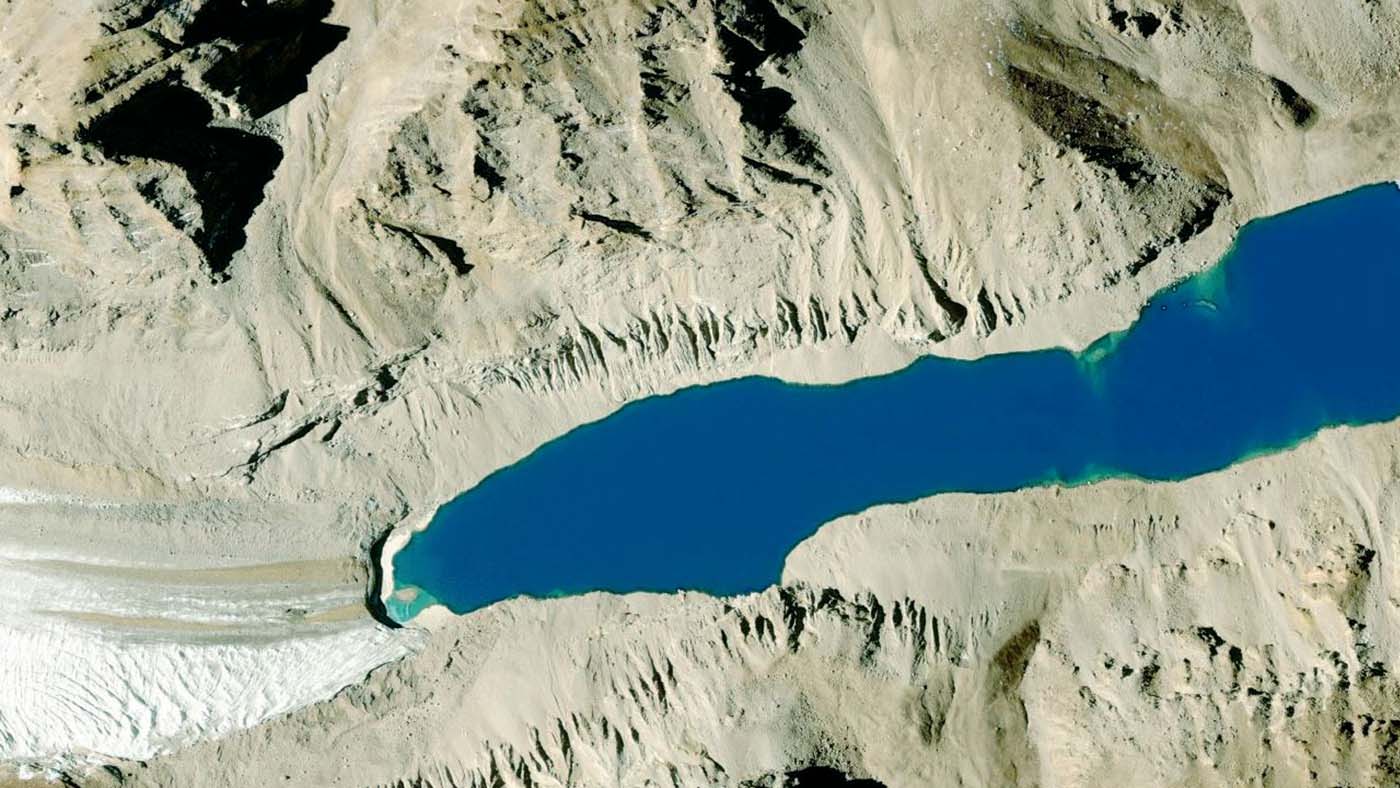
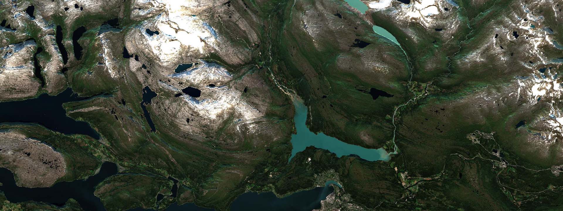
Glacier mapping and glacial lakes monitoring
Glacier mapping is key to ecological monitoring in the Hindu Kush Himalaya region. Climate change poses a risk to individuals whose livelihoods depend on the health of glacier ecosystems. In this work, we present a machine learning based approach to support ecological monitoring, with a focus on glaciers. Our approach is based on semi-automated mapping from satellite images.
Project materials > (opens in new tab) | Get the glacier mapping code > (opens in new tab)

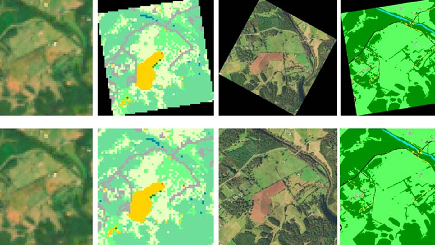
Land cover mapping
The land cover mapping problem, at country-level scales, is challenging for common deep learning methods due to the scarcity of high-resolution labels, as well as variation in geography and quality of input images. However, multiple satellite imagery and low-resolution ground truth label sources are widely available and can be used to improve model training efforts.
Project materials > | Explore land cover mapping downloads >
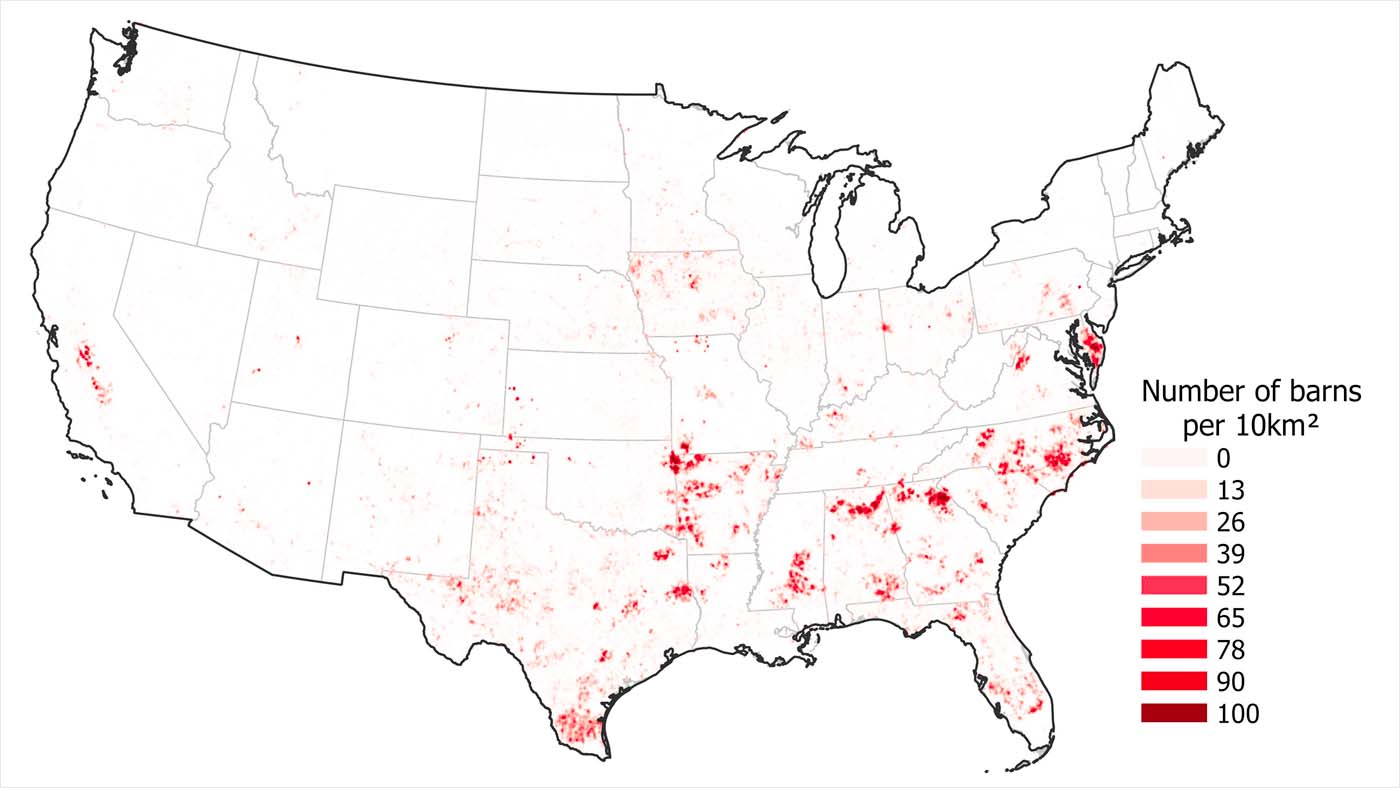
Poultry barn mapping
Commercial poultry operations are an important part of our food system; however, they can bring negative externalities to their local environments, including water and air pollution. To help monitor and safeguard our waterways and communities, we created the first open dataset of poultry barn locations across the continental United States. We use deep learning with high-resolution aerial imagery to identify poultry barns and release our model’s predictions for others to use in monitoring, research, and planning.
Publication > (opens in new tab) | Get the poultry locations dataset > (opens in new tab)
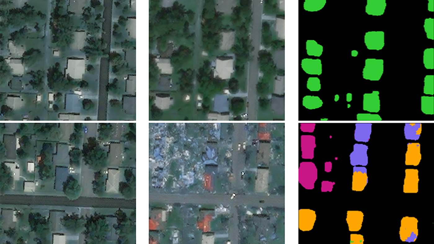
Building damage assessment
Natural disasters affect 350 million people each year. Allocating resources such as shelter, medical aid, and food would relieve people of pain most effectively if the impact of the disaster could be assessed in a short time frame after the disaster. In this study, we leverage high-resolution satellite imagery to conduct building footprint segmentation and train a classifier to assign each building’s damage severity level via an end-to-end deep learning pipeline. Knowing the damage to individual buildings will enable calculating accurately the number of shelters or most impacted areas by natural disasters required in large-scale disaster incidents.
Publication > (opens in new tab) | Get the damage assessment code > (opens in new tab)
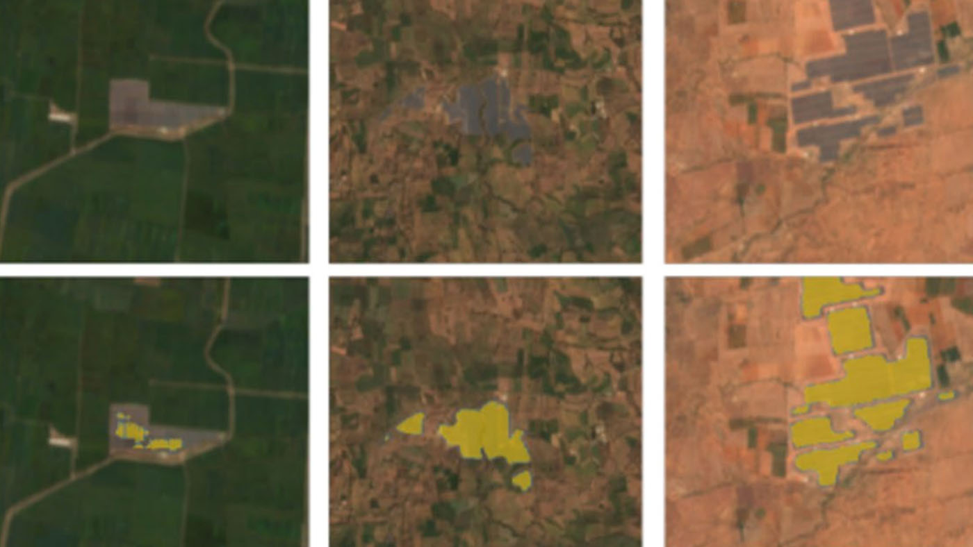
Renewable Energy Mapping
Rapid development of renewable energy sources is critical to mitigating climate change. Many countries are on an accelerated development track for renewable energy. Given the large land footprint needed to meet these renewable energy targets, the potential for land use conflicts over environmental and social values is high. To expedite the development of renewable energy while minimizing its environmental impact, land use planners will need access to up-to-date and accurate geospatial information of photovoltaic and wind infrastructure. We use geospatial machine learning to map and monitor renewable energy development at scale.
Publication > (opens in new tab) | Get the solar farms mapping code> (opens in new tab)
Intro to geospatial machine learning tutorial
Explore the world of geospatial machine learning with our tutorial, ‘Let’s map Africa! Intro to Geospatial Machine Learning.’ This tutorial covers the fundamentals of geospatial data, including vector and raster primitives, and takes you through an end-to-end geospatial machine learning workflow. You’ll gain a solid understanding of how to frame geospatial problems, acquire and preprocess data, and fit a model. We’ll also delve into diverse modeling approaches, including tabular learning with LightGBM and deep learning using Sequence-to-One models. Prerequisites include basic machine learning knowledge, Python programming skills, familiarity with deep learning, and hands-on experience with data preprocessing.
Access the Deep Learning Indaba 2023 tutorial on Github > (opens in new tab)
The Global Renewables Watch continually maps and measures renewable energy installations and their estimated capacities at the subnational, national, and global levels. It also provides unique spatial data on land use trends to help achieve the dual aims of environmental protection and increasing renewable energy capacity.
