Explore the universe and discover our home planet with the official NASA Tumblr account
ALT
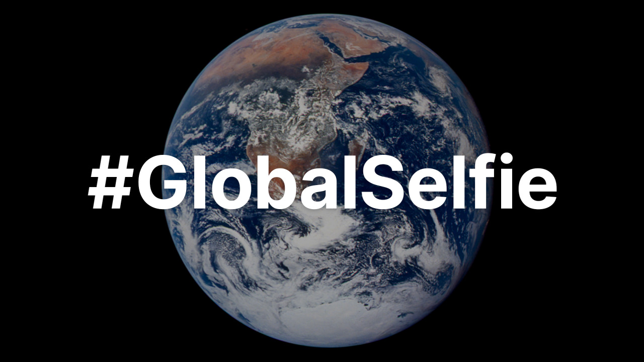
For Earth Day, we’re inviting you to take a moment to celebrate our wonderful water world, Earth. As far as we know, our Blue Marble is the only place in the universe with life, and that life depends on water. Snap a photo of yourself outside and tag it #GlobalSelfie – bonus points if your selfie features your favorite body of water! http://go.nasa.gov/3xFt0H0
Setting Sail to Travel Through Space: 5 Things to Know about our New Mission
Our Advanced Composite Solar Sail System will launch aboard Rocket Lab’s Electron rocket from the company’s Launch Complex 1 in Māhia, New Zealand no earlier than April 23, at 6 p.m. EDT. This mission will demonstrate the use of innovative materials and structures to deploy a next-generation solar sail from a CubeSat in low Earth orbit.
Meet BurstCube! This shoebox-sized satellite is designed to study the most powerful explosions in the cosmos, called gamma-ray bursts. It detects gamma rays, the highest-energy form of light.
BurstCube may be small, but it had a huge journey to get to space.
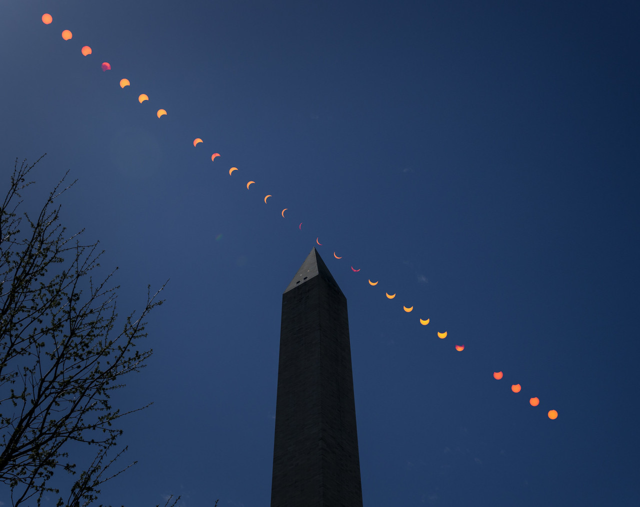
On Monday, April 8, 2024, there’ll be a total solar eclipse – and it’ll be the last one to cross North America for 20 years. Make sure you’re tuned in to our live broadcast for this exciting event: there’ll be views from along the path of totality, special guests, and plenty of science.
Follow, follow the Sun / And which way the wind blows / When this day is done 🎶 Today, April 8, 2024, the last total solar eclipse until 2045 crossed North America.
Our pale blue dot, planet Earth, is seen in this video captured by NASA astronaut Jack Fischer from his unique vantage point on the International Space Station. From 250 miles above our home planet, this time-lapse imagery takes us over the Pacific Ocean’s moon glint and above the night lights of San Francisco, CA. The thin hue of our atmosphere is visible surrounding our planet with a majestic white layer of clouds sporadically seen underneath.
The International Space Station is currently home to 6 people who are living and working in microgravity. As it orbits our planet at 17,500 miles per hour, the crew onboard is conducting important research that benefits life here on Earth.
We live on a water planet. The ocean covers a huge part of the Earth’s surface – earning it the name Blue Marble.
The ocean is one of Earth’s largest ecosystems and helps moderate Earth’s climate. NASA scientists spend a lot of time studying the ocean and how it is changing as Earth’s climate changes.
In the last few years, NASA has launched an array of missions dedicated to studying this precious part of our planet, with more to come. For World Oceans Month, which starts in June, here are new ways NASA studies the ocean.
Life. It’s the one thing that, so far, makes Earth unique among the thousands of other planets we’ve discovered. Since the fall of 1997, NASA satellites have continuously and globally observed all plant life at the surface of the land and ocean. During the week of Nov. 13-17, we are sharing stories and videos about how this view of life from space is furthering knowledge of our home planet and the search for life on other worlds.
Earth is the only planet with life, as far as we know. From bacteria in the crevices of the deepest oceans to monkeys swinging between trees, Earth hosts life in all different sizes, shapes and colors. Scientists often study Earth from the ground, but some also look to our satellites to understand how life waxes and wanes on our planet.
Over the years, scientists have used this aerial view to study changes in animal habitats, track disease outbreaks, monitor forests and even help discover a new species. While this list is far from comprehensive, these visual stories of bacteria, plants, land animals, sea creatures and birds show what a view from space can reveal.
1. Monitoring the single-celled powerhouses of the sea
Known as the grass of the ocean, phytoplankton are one of the most abundant types of life in the ocean. Usually single-celled, these plant-like organisms are the base of the marine food chain. They are also responsible for the only long-term transfer of carbon dioxide from Earth’s atmosphere to the ocean.
Even small changes in phytoplankton populations can affect carbon dioxide concentrations in the atmosphere, which could ultimately affect Earth’s global surface temperatures. Scientists have been observing global phytoplankton populations continuously since 1997 starting with the Sea-Viewing Wide Field-of View Sensor (SeaWiFS). They continue to study the small life-forms by satellite, ships and aircrafts.
2. Predicting cholera bacteria outbreaks
Found on the surface of zooplankton and in contaminated water, the bacteria that cause the infectious disease cholera — Vibrio cholerae — affect millions of people every year with severe diarrhea, sometimes leading to death. While our satellite sensors can’t detect the actual bacteria, scientists use various satellite data to look for the environmental conditions that the bacteria thrive in.
Specifically, microbiologist Rita Colwell at the University of Maryland, College Park, and West Virginia University hydrologist Antar Jutla studied data showing air and ocean temperature, salinity, precipitation, and chlorophyllconcentrations, the latter a marker for zooplankton. Anticipating where the bacteria will bloom helps researchers to mitigate outbreaks.
Recently, Colwell and Jutla have been able to estimate cholera risk after major events, such as severe storms, by looking at satellite precipitation data, air temperature, and population maps. The two maps above show the team’s predicted cholera risk in Haiti two weeks after Hurricane Matthew hit over October 1-2, 2016 and the actual reported cholera cases in October 2016.
3. Viewing life on land
From helping preserve forests for chimpanzees to predicting deer population patterns, scientists use our satellites to study wildlife across the world. Satellites can also see the impacts of perhaps the most relatable animal to us: humans. Every day, we impact our planet in many ways including driving cars, constructing buildings and farming – all of which we can see with satellites.
Our Black Marble image provides a unique view of human activity. Looking at trends in our lights at night, scientists can study how cities develop over time, how lighting and activity changes during certain seasons and holidays, and even aid emergency responders during power outages caused by natural disasters.
4. Tracking bird populations
Scientists use our satellite data to study birds in a variety of ways, from understanding their migratory patterns, to spotting potential nests, to tracking populations. In a rather creative application, scientists used satellite imagery to track Antarctica’s emperor penguin populations by looking for their guano – or excrement.
Counting emperor penguins from the ground perspective is challenging because they breed in some of the most remote and cold places in the world, and in colonies too large to easily count manually. With their black and white coats, emperor penguins are also difficult to count from an aerial view as they sometimes blend in with shadows on the ice. Instead, Phil Trathan and his colleagues at the British Antarctic Survey looked through Landsat imagery for brown stains on the sea ice. By looking for penguin droppings, Trathan said his team identified 54 emperor penguin colonies along the Antarctic coast.
5. Parsing out plant life
Just as we see plants grow and wilt on the ground, satellites observe the changes from space. Flourishing vegetation can indicate a lively ecosystem while changes in greenery can sometimes reveal natural disasters, droughts or even agricultural practices. While satellites can observe plant life in our backyards, scientists can also use them to provide a global picture.
Using data from satellites including SeaWiFS, and instruments including the NASA/NOAA Visible Infrared Imaging Radiometer Suite and the Moderate Resolution Imaging Spectroradiometer, scientists have the most complete view of global biology to date, covering all of the plant life on land and at the surface of the ocean.
They may look like rocks or plants on the seafloor, but corals are very much living animals. Receiving sustenance from photosynthetic plankton living within their calcium carbonate structures, coral reefs provide food and shelter for many kinds of marine life, protect shorelines from storms and waves, serve as a source for potential medicines, and operate as some of the most diverse ecosystems on the planet.
However, coral reefs are vulnerable to the warming of the ocean and human activity. Our satellites measure the surface temperature of ocean waters. These measurements have revealed rising water temperatures surrounding coral reef systems around the world, which causes a phenomenon known as “coral bleaching.” To add to the satellite data, scientists use measurements gathered by scuba divers as well as instruments flown on planes.
During the week of Nov. 13-17, check out our stories and videos about how this view of life from space is furthering knowledge of our home planet and the search for life on other worlds. Follow at www.nasa.gov/Earth.
Make sure to follow us on Tumblr for your regular dose of space: http://nasa.tumblr.com.
Studying our home planet is just as powerful as exploring what’s beyond it.
Surface Water and Ocean Topography (SWOT) is a joint mission developed by NASA and the French space agency Centre National d’Études Spatiales (CNES), with contributions from the Canadian Space Agency and the UK Space Agency. It will track water on more than 90% of Earth’s surface and help communities, scientists, and researchers better understand this finite and vital resource. And it’s launching this month!
So how will SWOT help us better understand Earth? Here are 5 ways.
ALT
SWOT will address some of the most pressing climate change questions of our time.
An important part of predicting our future climate is determining at what point Earth’s ocean water slows down its absorption of the excess heat in the atmosphere and starts releasing that heat back into the air, where it could accelerate global warming. SWOT will provide crucial information about this global heat exchange between the ocean and the atmosphere, enabling researchers to test and improve future climate forecasts.
The satellite will also offer insights to improve computer models for sea level rise projections and coastal flood forecasting.
Data from SWOT will additionally help scientists, engineers, water managers, and others better monitor drought conditions in lakes and reservoirs and improve flood forecasts for rivers.
ALT
SWOT is the first satellite mission that will observe nearly all water on the planet’s surface.
SWOT will measure the height of water in Earth’s lakes, rivers, reservoirs, and the ocean, giving scientists the ability to track the movement of water around the world.
SWOT’s eye in the sky will provide a truly global view of the water on more than 90% of Earth’s surface, enriching humankind’s understanding of how the ocean reacts to and influences climate change along with what potential hazards – including floods – lie ahead in different regions of the world.
ALT
SWOT will see Earth’s water in higher definition than ever before.
Because everything is better in HD 😉, SWOT will view Earth’s ocean and freshwater bodies with unprecedented clarity compared to other satellites, much like a high-definition television delivers a picture far more detailed than older models. This means that SWOT will be able to “see” ocean features – like fronts and eddies – that are too small for current space-based instruments to detect. Those measurements will help improve researchers’ understanding of the ocean’s role in climate change.
Not only will the satellite show where – and how fast – sea level is rising, it will also reveal how coastlines around the world are changing. It will provide similar high-definition clarity for Earth’s lakes, rivers, and reservoirs, many of which remain a mystery to researchers, who aren’t able to outfit every water body with monitoring instruments.
ALT
SWOT data will be used to help make decisions about our daily lives and livelihoods.
As climate change accelerates the water cycle, more communities around the world will be inundated with water while others won’t have enough. SWOT data will be used to monitor drought conditions and improve flood forecasts, providing essential information to water management agencies, disaster preparedness agencies, universities, civil engineers, and others who need to track water in their local areas. SWOT data also will help industries, like shipping, by providing measurements of water levels along rivers, as well as ocean conditions, including tides, currents, and storm surges.
ALT
Finally … SWOT will pave the way for future Earth missions.
With its innovative technology and commitment to engaging a diverse community of people who plan to use data from the mission, SWOT is blazing a trail for future Earth-observing missions. SWOT’s data and the tools to support researchers in analyzing the information will be free and accessible. This will help to foster research and applications activities by a wide range of users, including scientists, resource managers, and others who in the past may not have had the opportunity to access this kind of information. Lessons learned from SWOT will lead to new questions and improvements for future missions, including our upcoming Earth System Observatory, a constellation of missions focused on studying key aspects of our home planet.
ALT
Keep track of the mission here. And make sure to follow us on Tumblr for your regular dose of space!
On May 4, 2017, after three months of precisely coordinated maneuvers, MMS reached its new orbit to begin studying the magnetic environment on the ever-rotating nighttime side of Earth.
The space around Earth is not as empty as it looks. It’s packed with high energy electrons and ions that zoom along magnetic field lines and surf along waves created by electric and magnetic fields.
MMS studies how these particles move in order to understand a process known as magnetic reconnection, which occurs when magnetic fields explosively collide and re-align.
After launch, MMS started exploring the magnetic environment on the side of Earth closest to the sun. Now, MMS has been boosted into a new orbit that tops out twice as high as before, at over 98,000 miles above Earth’s surface.
The new orbit will allow the spacecraft to study magnetic reconnection on the night side of Earth, where the process is thought to cause the northern and southern lights and energize particles that fill the radiation belts, a doughnut-shaped region of trapped particles surrounding Earth.
MMS uses four separate but identical spacecraft, which fly in a tight pyramid formation known as a tetrahedron. This allows MMS to map the magnetic environment in three dimensions.
MMS made many discoveries during its first two years in space, and its new orbit will open the door to even more. The information scientists get from MMS will help us better understand our space environment, which helps in planning future missions to explore even further beyond our planet. Learn more about MMS at nasa.gov/mms.
Today — June 20, 2024 — is the northern summer solstice. In the Northern Hemisphere, it marks the longest day of the year and the official start to summer.

 ALT
ALT