
- Dataset Availability
- 2016-01-01T00:00:00Z–2023-12-01T00:00:00Z
- Dataset Provider
- OpenET, Inc.
- Earth Engine Snippet
-
ee.ImageCollection("OpenET/SSEBOP/CONUS/GRIDMET/MONTHLY/v2_0") - Tags
Description
Operational Simplified Surface Energy Balance (SSEBop)
The Operational Simplified Surface Energy Balance (SSEBop) model by Senay et al. (2013, 2017) is a thermal-based simplified surface energy model for estimating actual ET based on the principles of satellite psychrometry (Senay 2018). The OpenET SSEBop implementation uses land surface temperature (Ts) from Landsat (Collection 2 Level-2 Science Products) with key model parameters (cold/wet-bulb reference, Tc, and surface psychrometric constant, 1/dT) derived from a combination of observed surface temperature, normalized difference vegetation index (NDVI), climatological average (1980-2017) daily maximum air temperature (Ta, 1-km) from Daymet, and net radiation data from ERA-5. This model implementation uses the Google Earth Engine processing framework for connecting key SSEBop ET functions and algorithms together when generating both intermediate and aggregated ET results. A detailed study and evaluation of the SSEBop model across CONUS (Senay et al., 2022) informs both cloud implementation and assessment for water balance applications at broad scales. Notable model (v0.2.6) enhancements and performance against previous versions include additional compatibility with Landsat 9 (launched Sep 2021), global model extensibility, and improved parameterization of SSEBop using FANO (Forcing and Normalizing Operation) to better estimate ET in all landscapes and all seasons regardless of vegetation cover density, thereby improving model accuracy by avoiding extrapolation of Tc to non-calibration regions.
Bands
Resolution
30 meters
Bands
| Name | Units | Description |
|---|---|---|
et |
mm | SSEBop ET value |
count |
count | Number of cloud free values |
Image Properties
Image Properties
| Name | Type | Description |
|---|---|---|
| build_date | STRING | Date assets were built |
| cloud_cover_max | DOUBLE | Maximum CLOUD_COVER_LAND percent value for Landsat images included in interpolation |
| collections | STRING | List of Landsat collections for Landsat images included in the interpolation |
| core_version | STRING | OpenET core library version |
| end_date | STRING | End date of month |
| et_reference_band | STRING | Band in et_reference_source that contains the daily reference ET data |
| et_reference_resample | STRING | Spatial interpolation mode to resample daily reference ET data |
| et_reference_source | STRING | Collection ID for the daily reference ET data |
| interp_days | DOUBLE | Maximum number of days before and after each image date to include in interpolation |
| interp_method | STRING | Method used to interpolate between Landsat model estimates |
| interp_source_count | DOUBLE | Number of available images in the interpolation source image collection for the target month |
| mgrs_tile | STRING | MGRS grid zone ID |
| model_name | STRING | OpenET model name |
| model_version | STRING | OpenET model version |
| scale_factor_count | DOUBLE | Scaling factor that should be applied to the count band |
| scale_factor_et | DOUBLE | Scaling factor that should be applied to the et band |
| start_date | STRING | Start date of month |
Terms of Use
Terms of Use
Citations
Senay, G.B., Parrish, G.E., Schauer, M., Friedrichs, M., Khand, K., Boiko, O., Kagone, S., Dittmeier, R., Arab, S. and Ji, L., 2023. Improving the Operational Simplified Surface Energy Balance Evapotranspiration Model Using the Forcing and Normalizing Operation. Remote Sensing, 15(1), p.260. doi:10.3390/rs15010260
Senay, G.B., Bohms, S., Singh, R.K., Gowda, P.H., Velpuri, N.M., Alemu, H. and Verdin, J.P., 2013. Operational evapotranspiration mapping using remote sensing and weather datasets: A new parameterization for the SSEB approach. JAWRA Journal of the American Water Resources Association, 49(3), pp.577-591. doi:10.1111/jawr.12057
Senay, G.B., Schauer, M., Friedrichs, M., Velpuri, N.M. and Singh, R.K., 2017. Satellite-based water use dynamics using historical Landsat data (1984–2014) in the southwestern United States. Remote Sensing of Environment, 202, pp.98-112. doi:10.1016/j.rse.2017.05.005c
Senay, G.B., 2018. Satellite psychrometric formulation of the Operational Simplified Surface Energy Balance (SSEBop) model for quantifying and mapping evapotranspiration. Applied Engineering in Agriculture, 34(3), pp.555-566. doi:10.13031/aea.12614
Senay, G.B., Friedrichs, M., Morton, C., Parrish, G.E., Schauer, M., Khand, K., Kagone, S., Boiko, O. and Huntington, J., 2022. Mapping actual evapotranspiration using Landsat for the conterminous United States: Google Earth Engine implementation and assessment of the SSEBop model. Remote Sensing of Environment, 275, p.113011. doi:10.1016/j.rse.2022.113011
DOIs
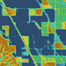
Explore with Earth Engine
Code Editor (JavaScript)
var dataset = ee.ImageCollection('OpenET/SSEBOP/CONUS/GRIDMET/MONTHLY/v2_0')
  .filterDate('2020-01-01', '2021-01-01');

// Compute the annual evapotranspiration (ET) as the sum of the monthly ET
// images for the year.
var et = dataset.select('et').sum();

var visualization = {
  min: 0,
  max: 1400,
  palette: [
    '9e6212', 'ac7d1d', 'ba9829', 'c8b434', 'd6cf40', 'bed44b', '9fcb51',
    '80c256', '61b95c', '42b062', '45b677', '49bc8d', '4dc2a2', '51c8b8',
    '55cece', '4db4ba', '459aa7', '3d8094', '356681', '2d4c6e',
  ]
};

Map.setCenter(-100, 38, 5);

Map.addLayer(et, visualization, 'OpenET SSEBop Annual ET');