


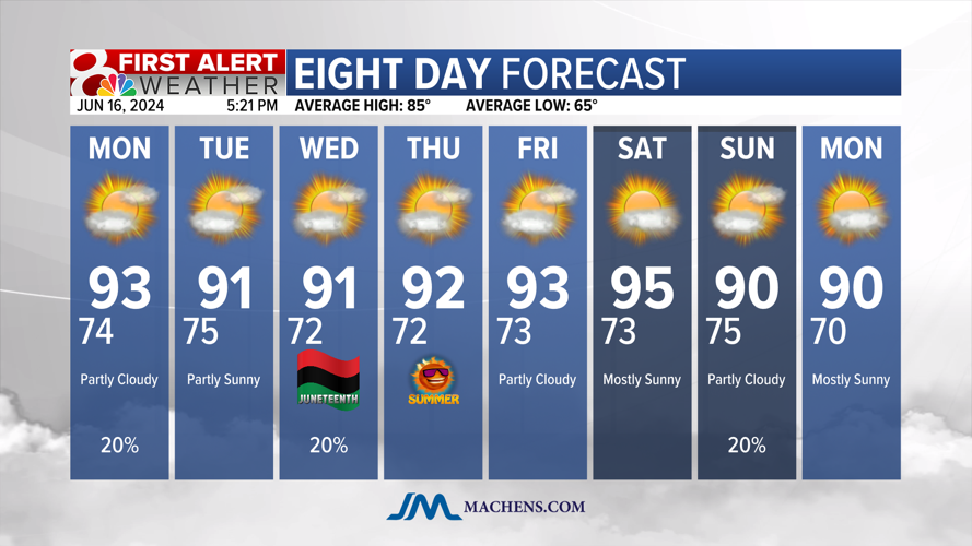


We hit our first 90° day of the year last Thursday and since then we’ve been sitting with highs in the upper 80s on Friday and Saturday. Today we hit the 90° mark again.

Heat and humidity aren’t going anywhere anytime soon! Highs are expected to be around 90° through the week.

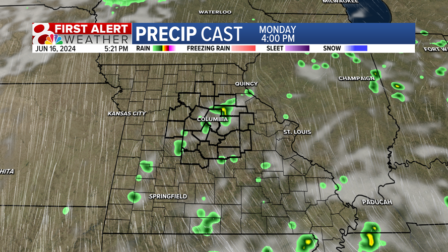
MONDAY’S WEATHER
Morning temperatures will start in the middle 70s as warm and humid air stays in place. Through Monday cloud cover will increase as highs warm to the lower 90s with a heat index in the upper 90s.

As cloud cover increases, we’ll watch for a chance for a few very isolated showers and thunderstorms. Most of the region will stay dry, but a few stray storms are possible.

LOOKING AHEAD
Stay storm chances remain in the forecast to our southeast on Tuesday, but back over mid-Missouri on Wednesday. Again, most of us will see no rainfall.
Humidity will remain with dew points ranging from the middle to upper 60s, meaning it’s going to feel sticky to tropical across the region.

That humidity will factor into our daily high temperatures to give us heat index values in the middle to upper 90s.

No significant relief from the heat is in the forecast. We’ll watch for a weak cold front towards the end of the weekend. As the heat of summer lingers, don’t forget to stay hydrated and check on those around you.


