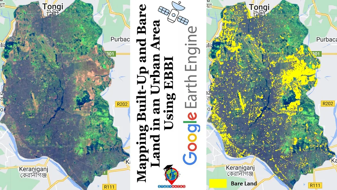
Study Hacks (Institute of GIS and Remote sensing)Mapping Built-Up and Bare Land in an Urban Area Using EBBI on Google Earth EngineUrbanization is a critical factor influencing land use and environmental change. Accurately mapping built-up and bare land areas is…3 min read·May 23, 2024--
Google EarthinGoogle Earth and Earth EnginePython Powers Up: The Rise of the Python API for Earth EngineBy Justin Braaten, Developer Relations; Alex Merose, Software Engineer; & Nate Schmitz, Software Engineer5 min read·Oct 26, 2023--9
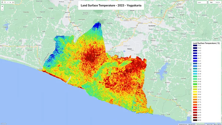
Muhammad RidhoAnalyzing Land Surface Temperature (LST) with Landsat 8 Data in Google Earth EngineLand Surface Temperature (LST) is a crucial environmental parameter with applications ranging from climate change monitoring to urban…9 min read·Sep 22, 2023--7--7
Kavyajeet BoraMonitoring Inland Surface Water Area using Google Earth Engine & PythonThis article guides you through creating an animated GIF and time-series to visualize changes in surface water area over the years8 min read·May 23, 2024--2--2
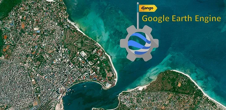
BkesInteractive web mapping with Django and Google Earth EngineIn this example, GEE is used for web mapping with Python Django. Django is a fully-featured Python web framework that can be used to build…4 min read·May 15, 2024----
Study Hacks (Institute of GIS and Remote sensing)Mapping Built-Up and Bare Land in an Urban Area Using EBBI on Google Earth EngineUrbanization is a critical factor influencing land use and environmental change. Accurately mapping built-up and bare land areas is…3 min read·May 23, 2024--
Google EarthinGoogle Earth and Earth EnginePython Powers Up: The Rise of the Python API for Earth EngineBy Justin Braaten, Developer Relations; Alex Merose, Software Engineer; & Nate Schmitz, Software Engineer5 min read·Oct 26, 2023--9
Muhammad RidhoAnalyzing Land Surface Temperature (LST) with Landsat 8 Data in Google Earth EngineLand Surface Temperature (LST) is a crucial environmental parameter with applications ranging from climate change monitoring to urban…9 min read·Sep 22, 2023--7
Kavyajeet BoraMonitoring Inland Surface Water Area using Google Earth Engine & PythonThis article guides you through creating an animated GIF and time-series to visualize changes in surface water area over the years8 min read·May 23, 2024--2
BkesInteractive web mapping with Django and Google Earth EngineIn this example, GEE is used for web mapping with Python Django. Django is a fully-featured Python web framework that can be used to build…4 min read·May 15, 2024--
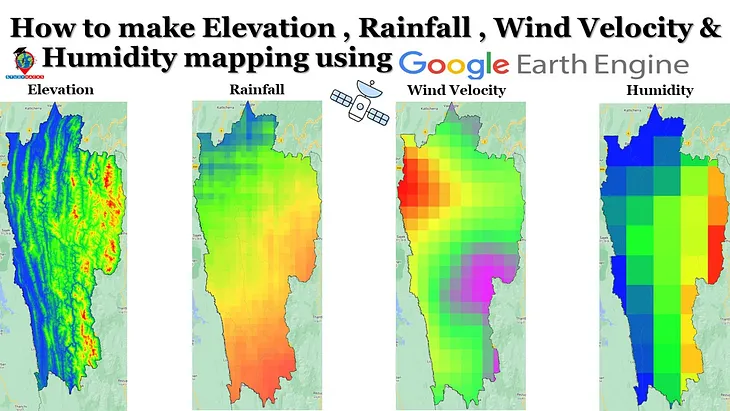
Study Hacks (Institute of GIS and Remote sensing)How to make Elevation, Rainfall, Wind Velocity & Humidity mapping using Google Earth EngineMapping Elevation, Rainfall, Wind Velocity, and Humidity Using Google Earth Engine3 min read·May 23, 2024--
Pulakesh PradhanSentinel-1 SAR Data Pre-processing in Google Earth Engine (GEE)By Pulakesh Pradhan, PhD Scholar in Geography6 min read·Jan 13, 2024--2
BkesLand Cover MappingThe surface of the Earth is continuously changing at many levels; local, regional, national, and global scales. Changes in land use and…8 min read·May 15, 2024--