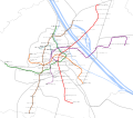
File:U-Map Vienna St5.svg
From Wikimedia Commons, the free media repository
Jump to navigation
Jump to search

Size of this PNG preview of this SVG file: 667 × 600 pixels. Other resolutions: 267 × 240 pixels | 534 × 480 pixels | 854 × 768 pixels | 1,139 × 1,024 pixels | 2,278 × 2,048 pixels | 2,176 × 1,956 pixels.
Original file (SVG file, nominally 2,176 × 1,956 pixels, file size: 3.68 MB)
File information
Structured data
Captions
Captions
Add a one-line explanation of what this file represents
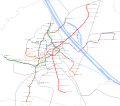
Geografisch korrekte Darstellung des Wiener U-Bahn-Netzes mit allen Ausbauten bis zur 5. Ausbaustufe
Summary
[edit]| DescriptionU-Map Vienna St5.svg |
Deutsch: Dargestellt sind die Wiener U-Bahnlinien in ihrer Kennfarbe mit Stationen. Zusätzlich sind Bahnstrecken, Gewässer und die Wiener Stadtgrenze abgebildet. |
| Date | |
| Source | Own work |
| Author | Gnlpfth12 |
Licensing
[edit]I, the copyright holder of this work, hereby publish it under the following license:
This file is licensed under the Creative Commons Attribution-Share Alike 4.0 International license.
- You are free:
- to share – to copy, distribute and transmit the work
- to remix – to adapt the work
- Under the following conditions:
- attribution – You must give appropriate credit, provide a link to the license, and indicate if changes were made. You may do so in any reasonable manner, but not in any way that suggests the licensor endorses you or your use.
- share alike – If you remix, transform, or build upon the material, you must distribute your contributions under the same or compatible license as the original.
File history
Click on a date/time to view the file as it appeared at that time.
| Date/Time | Thumbnail | Dimensions | User | Comment | |
|---|---|---|---|---|---|
| current | 07:37, 4 August 2021 |  | 2,176 × 1,956 (3.68 MB) | Gnlpfth12 (talk | contribs) | +Bezirke |
| 23:00, 3 August 2021 |  | 1,106 × 979 (1.04 MB) | Kematen (talk | contribs) | . | |
| 21:10, 3 August 2021 |  | 1,106 × 979 (1.04 MB) | Kematen (talk | contribs) | Stationen, die nicht in Betrieb sind, strichliert | |
| 23:07, 2 August 2021 |  | 2,176 × 1,956 (3.06 MB) | Gnlpfth12 (talk | contribs) | Namen vergößert, An den alten Schanzen ergänzt (2024) | |
| 22:48, 2 August 2021 |  | 2,176 × 1,956 (3 MB) | Gnlpfth12 (talk | contribs) | Linienfarben korrigiert, Bebauung ergänzt, Typos | |
| 21:45, 29 July 2021 |  | 1,106 × 979 (1.04 MB) | Kematen (talk | contribs) | Reverted to version as of 17:16, 29 July 2021 (UTC) Die 5. Ausbaustufe ist in Planung. Zum Frankhplatz/Matzleinsdorfer Platz wird schon gebaut. Du verstehst es einfach nicht. Ich habe den Wr. Linien geschrieben, wie das jetzt ist. Wie schon gesagt - es ist geplant bis nach Hernals/Gutheil-Schoder-Gasse zu bauen. Du wirst sicher sagen:"Haha. Es ist der Plan..." Es stimmt. Aber die Gußriegelstraße, Wienerberg, Arne-Karlsson-Park, Michelbeuern und der Elterleinplatz ist auch nur "der Plan". Es... | |
| 21:33, 29 July 2021 |  | 1,106 × 979 (1.04 MB) | Gnlpfth12 (talk | contribs) | Reverted to version as of 09:23, 4 October 2019 (UTC) ein YouTube Video als seriöse Quelle? Ernsthaft? Und wo ist da von der 5. Ausbaustufe die Rede? Lieber nochmal aufmerksam anschauen! | |
| 17:16, 29 July 2021 |  | 1,106 × 979 (1.04 MB) | Kematen (talk | contribs) | Reverted to version as of 15:24, 29 July 2021 (UTC) Wiener Linien planen in der 5. Ausbauphase nicht bis zum Wienerberg und Elterleinplatz sondern zur Gutheil-Schoder-Gasse und Hernals zu bauen (siehe letztes YouTube-Video) | |
| 16:26, 29 July 2021 |  | 1,106 × 979 (1.04 MB) | Gnlpfth12 (talk | contribs) | Reverted to version as of 14:26, 29 July 2021 (UTC): falsche Eintragungen, die nicht zur 5. Ausbaustufe gehören | |
| 15:24, 29 July 2021 |  | 1,106 × 979 (1.04 MB) | Kematen (talk | contribs) | Reverted to version as of 20:57, 27 July 2021 (UTC) |
You cannot overwrite this file.
File usage on Commons
The following 6 pages use this file:
- User:Chumwa/OgreBot/Potential transport maps/2019 October 1-10
- User:Chumwa/OgreBot/Public transport information/2019 October 1-10
- User:Chumwa/OgreBot/Public transport information/2021 August 1-10
- User:Chumwa/OgreBot/Transport Maps/2019 October 1-10
- User:Chumwa/OgreBot/Transport Maps/2021 August 1-10
- User:Chumwa/OgreBot/Travel and communication maps/2019 October 1-10
Metadata
This file contains additional information such as Exif metadata which may have been added by the digital camera, scanner, or software program used to create or digitize it. If the file has been modified from its original state, some details such as the timestamp may not fully reflect those of the original file. The timestamp is only as accurate as the clock in the camera, and it may be completely wrong.
| Width | 614.23981mm |
|---|---|
| Height | 552.00482mm |
Hidden categories:
